Contact Us : Monday – Friday (09:00 AM – 06:00 PM) | Bangalore | Bhubaneswar

Solutions & Services

  • Home
  • Solutions & Services
Our Services

Technology-Driven Solutions by Krishi Vruddhi

Automatic Weather Stations (AWS)

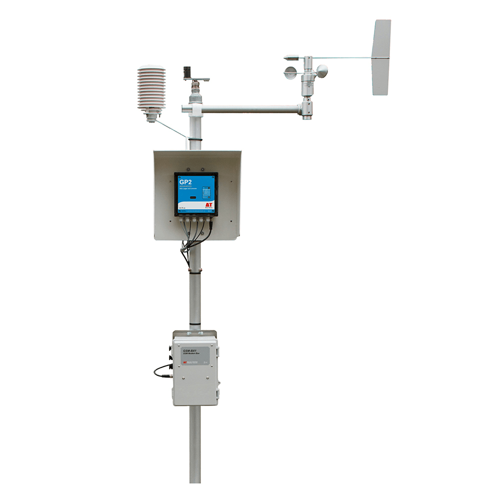
Our hyperlocal Automatic Weather Stations provide accurate, real-time weather forecasts, help farmers plan irrigation, sowing and harvesting efficiently. By leveraging multi-source data and AI-driven insights, we empower farmers to make informed decisions which could be help them to reduce crop loss and maximise productivity in their specific fields and agroclimatic conditions.

Lightning Detection Station (LDRS) & Sensors

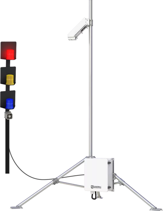
The Lightning Detection Radar & Sensors system issues early alerts for lightning and severe weather, protecting both crops and farmers. By spotting potential dangers ahead of time, it allows for timely preventive measures that minimize damage. This ensures that farming operations can continue safely, even in unpredictable weather.

Satellite Imagery Analytics

Satellite imagery combined with AI offers general yet useful crop advice. Farmers receive information about water stress, nutrition deficiency, pest infestations, and the overall health of their crops. We also identify affected locations and prescribe remedies, allowing proactive management while optimising resources and costs, leading to healthier crops and higher yields.

Drone Imagery & Targeted Solutions

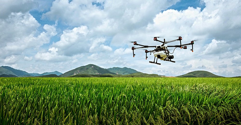
Drone technology offers crop-specific solutions for precise interventions. It aids in early yield estimates, pest detection and calculating sugar content in sugarcane. Drones enable geo-fenced, which helps for targeted spraying of fertilizers or pesticides within defined areas. This ensures that resources are applied only where necessary, saving money and improving productivity for each cultivated area.

cta_1_1

Boost per-acre income by ₹5,000–₹12,000 per season

cta_1_2

Reduce crop failure by up to 40%

SOLUTIONS & SERVICES

Krishi Vruddhi (KV) seeks to enhance agricultural productivity and minimise crop loss via a hyperlocal, technology-driven advisory system. It employs a multi-source data strategy and AI models for crop intelligence, enabling farmers to make informed, data-driven choices about their crops while incorporating best practices and real-world insights.

Technology Backbone

Automatic Weather Stations (AWS) with IOT sensors

  • Function: These Automatic Weather Stations collect real-time hyperlocal weather data from the exact location of the farm, which can typically cover from 500 to 1000 acres of cultivation.
  • Data Captured: Rainfall, temperature, humidity, wind speed, wind direction, barometric pressure and more.
  • Purpose:
    • Enables accurate weather forecasting at the micro-level.
    • Helps determine ideal irrigation times and disease susceptibility windows.

Lightning Detection & Early Warning Systems (LDRS)

  • Function: Uses radar and Ultra-High / Very-High / High / Low frequency sensors to detect lightning and electrical activity in the atmosphere. A close watch on increasing in-cloud lightning activity leads to predicting cloud-to-ground lightning strikes with 95% detection accuracy and 200 metre location accuracy using the best technology in the world
  • Purpose: Sends early alerts to farmers 30 to 45 minutes ahead of a potential lightning strike to take shelter.
  •  

Satellite Imagery

  • Usage: Large-scale observation of farm lands to detect:
    • Water Stress: Areas where irrigation is lacking or excessive.
    • Nutritional Stress: Signs of nutrient deficiencies or toxicities.
    • Pests, Diseases, fungus, insects and Weeds: Early signs of infestation or infection.
  • Outcome: Helps provide a general crop advisory to farmers based on regional analysis.

Drone Imagery

  • Usage: Provides high-resolution images using RGB, Hyperspectral & multispectral cameras of specific fields for identification of the specific problem the crop is facing.
  • Purpose:
    • Delivers specific advice for specific crops within an agroclimatic zone.
    • Example Focus Area: Sugarcane in Belagavi
      • Yield Estimation: Helps predict the income a farmer can expect.
      • Borer Detection: Identifies infestation by borer insects and recommends treatment only for affected areas, saving cost and resources.
      • Pol% (Sucrose Content): Detects the ripeness of different sub-plots, suggesting optimal harvest timing for better sugar yield.

Precision Agriculture Through Automation

Identifying stress zones, such as areas affected by pests or lacking nutrients, is crucial for targeted solutions. Automated spraying involves geo-tagging problem areas, allowing drones to follow pre-set flight paths to apply insecticides specifically in zones affected by borers. Fertilizers will only be used in areas where nutrient stress is detected. This approach reduces both input costs and environmental impact.

Why It Matters:

Cost-Effective:

Targeted interventions mean less input wastage.

Scalable

Can be deployed across different crop types and regions.

Farmer-Friendly

Designed to be accessible for small and marginal farmers using mobile technology.